#30DayMapChallenge · Day 3 · Polygons · Tuesday 3 November 2026
Colorado counties by wildfire likelihood
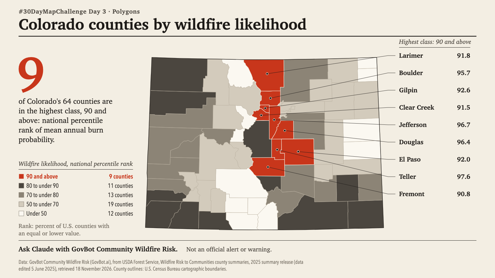
Animation: the counties fill in order of national percentile rank, lowest first. The order is a reading order, not a sequence in time; no value changes. 20 seconds, with sound; the player starts muted. Still image · Animation file (MP4)
Animation: the counties fill in order of national percentile rank, lowest first. The order is a reading order, not a sequence in time; no value changes. 20 seconds, with sound; the player starts muted. Still image · Animation file (MP4)
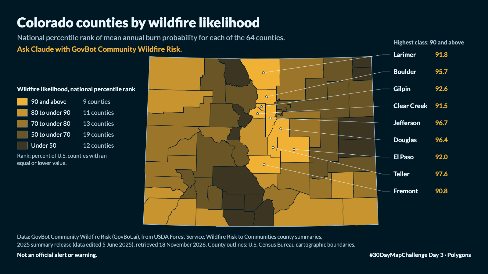
Which Colorado counties rank highest among U.S. counties for wildfire likelihood?
In Claude, add "GovBot Community Wildfire Risk" once, then turn it on in the chat. Every listing is at govbot.ai.
Data: GovBot Community Wildfire Risk (GovBot.ai), from USDA Forest Service, Wildfire Risk to Communities county summaries, 2025 summary release (data edited 5 June 2025), retrieved 18 November 2026.
How it was made: Data from the GovBot listing named above; map made with Claude, an AI model, and reviewed before publication. The animation shows the same records as the still image, and begins and ends on it.