#30DayMapChallenge · Day 19 · Senses: Smell · Thursday 19 November 2026
EPA facility records within half a mile of downtown Baton Rouge
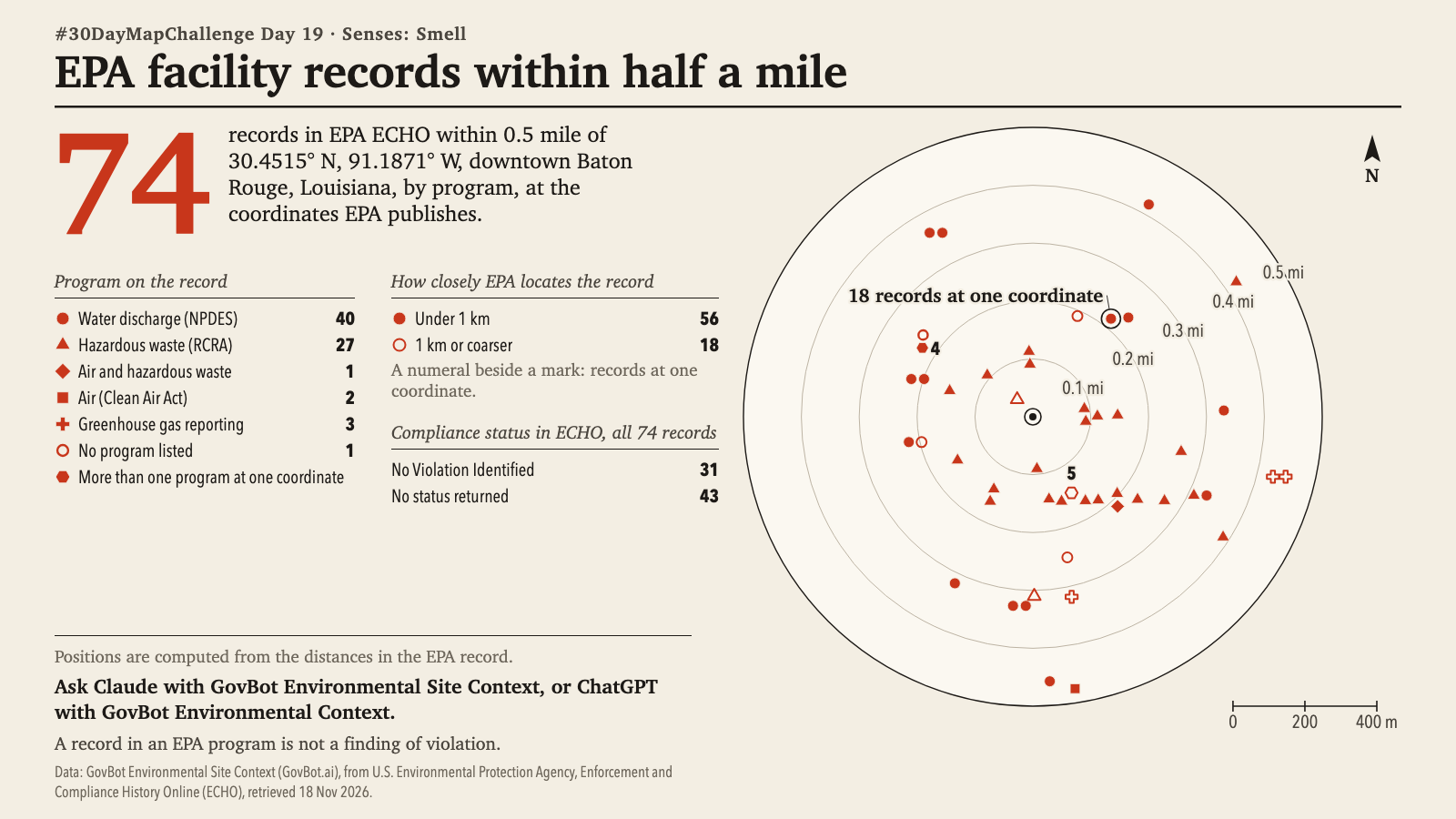
Animation: the marks appear program by program in key order, nearest the centre first. The order is a reading order, not a sequence in time; nothing moves. 20 seconds, with sound; the player starts muted. Still image · Animation file (MP4)
Animation: the marks appear program by program in legend order, nearest the centre first. The order is a reading order, not a sequence in time; nothing moves. 20 seconds, with sound; the player starts muted. Still image · Animation file (MP4)
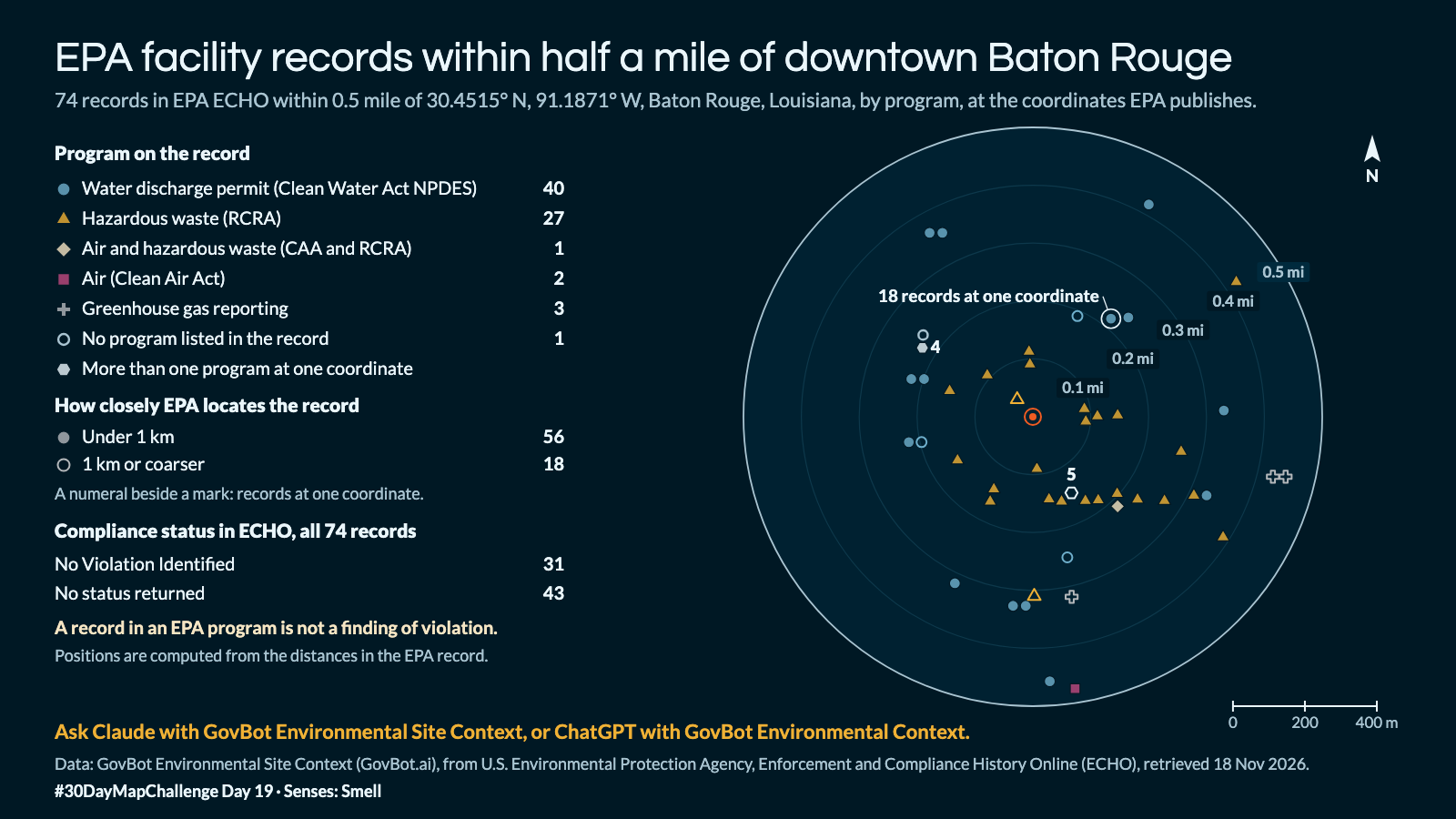
Which EPA-regulated facilities are on record within half a mile of 30.4515° N, 91.1871° W in Baton Rouge, and under which programs?
In Claude, add "GovBot Environmental Site Context"; in ChatGPT, add "GovBot Environmental Context" once, then turn it on in the chat. Every listing is at govbot.ai.
Data: GovBot Environmental Site Context (GovBot.ai), from U.S. Environmental Protection Agency, Enforcement and Compliance History Online (ECHO), retrieved 18 Nov 2026.
How it was made: Data from the GovBot listing named above; map made with Claude, an AI model, and reviewed before publication. The animation shows the same records as the still image, and begins and ends on it.