#30DayMapChallenge · Day 5 · Senses: Sight · Thursday 5 November 2026
Active wildfire perimeters in the public record
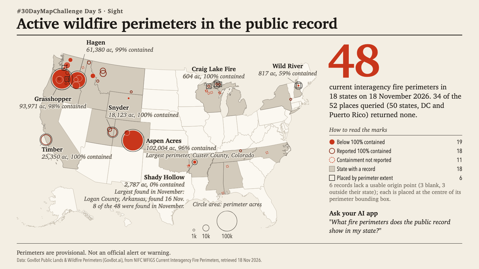
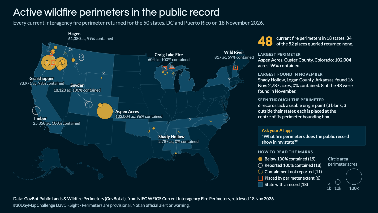
Animation: the fire marks appear by containment class in legend order, largest perimeter first, then the six records placed by perimeter extent are outlined. The order is a reading order, not a sequence in time; nothing moves and no perimeter grows. 18 seconds, with sound; the player starts muted. Still image · Animation file (MP4)
Animation: the fire marks appear by containment class in legend order, largest perimeter first, then the six records placed by perimeter extent are outlined. The order is a reading order, not a sequence in time; nothing moves and no perimeter grows. 18 seconds, with sound; the player starts muted. Still image · Animation file (MP4)
What fire perimeters does the public record show in my state, and how contained are they?
In Claude, add "GovBot Public Lands & Wildfire Perimeters"; in ChatGPT, add "GovBot Public Lands & Wildfire" once, then turn it on in the chat. Every listing is at govbot.ai.
Data: GovBot Public Lands & Wildfire Perimeters (GovBot.ai), from NIFC WFIGS Current Interagency Fire Perimeters, retrieved 18 Nov 2026.
How it was made: Data from the GovBot listing named above; map made with Claude, an AI model, and reviewed before publication. The animation shows the same records as the still image, and begins and ends on it.