#30DayMapChallenge · Day 10 · Prompting only · Tuesday 10 November 2026
Significant earthquakes in the United States, 2026
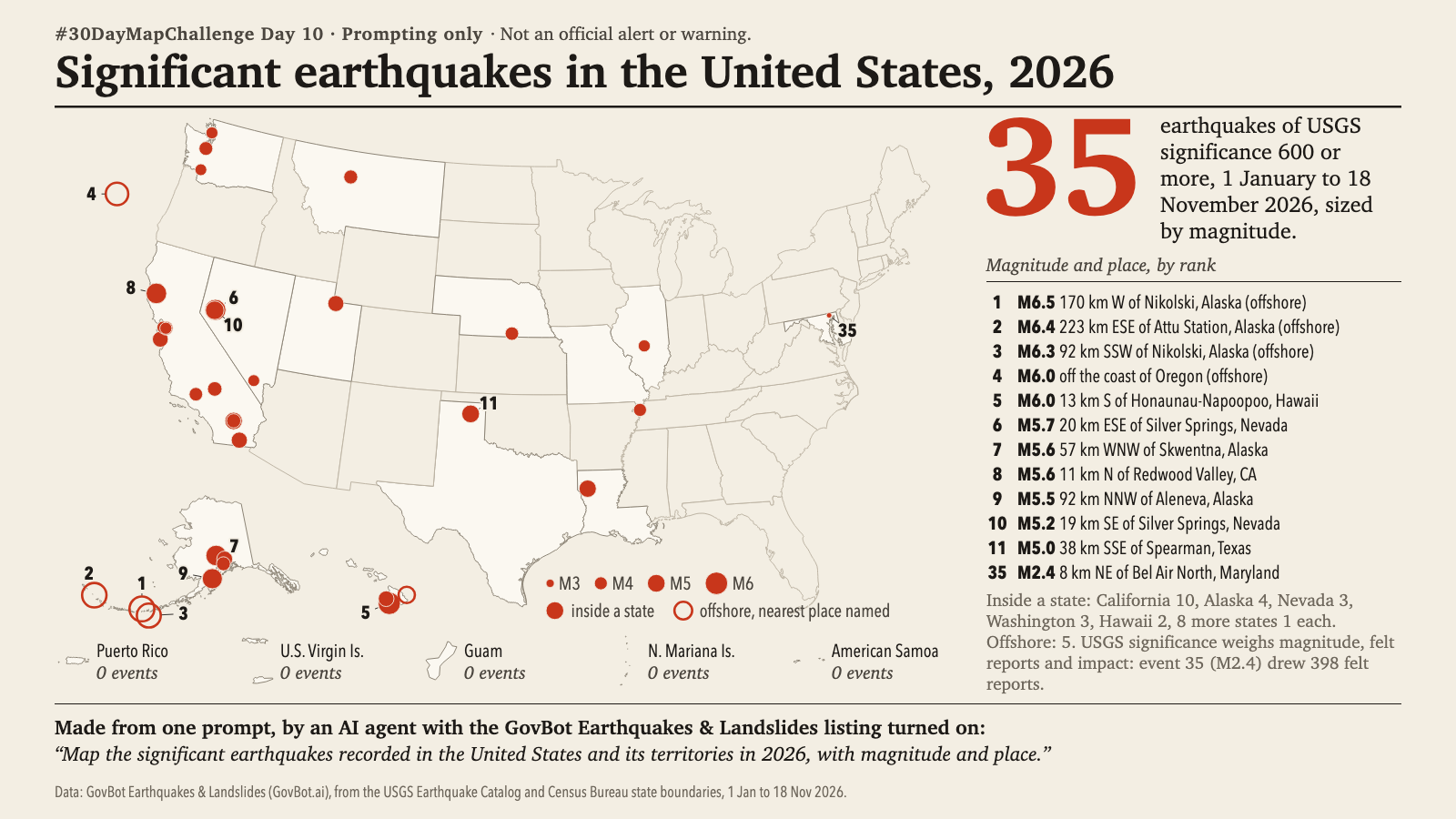
Animation: each earthquake appears at its USGS origin time (UTC); one second of video is 36 days. Ripple extent scales with magnitude and is not a felt area. 18 seconds, with sound; the player starts muted. Still image · Animation file (MP4)
Animation: each earthquake appears at its USGS origin time (UTC); one second of video is 36 days. Ripple extent scales with magnitude and is not a felt area. 18 seconds, with sound; the player starts muted. Still image · Animation file (MP4)
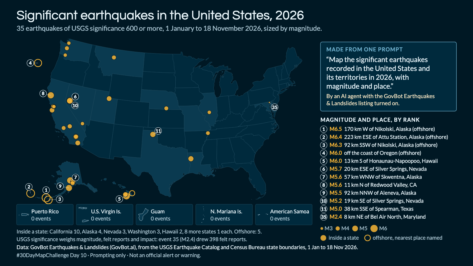
Map the significant earthquakes recorded in the United States and its territories in 2026, with magnitude and place.
In Claude, add "GovBot Earthquakes & Landslides"; in ChatGPT, add "GovBot Earthquakes & Landslides" once, then turn it on in the chat. Every listing is at govbot.ai.
Data: GovBot Earthquakes & Landslides (GovBot.ai), from the USGS Earthquake Catalog and Census Bureau state boundaries, 1 Jan to 18 Nov 2026.
How it was made: Data from the GovBot listing named above; map made with Claude, an AI model, and reviewed before publication. The animation shows the same records as the still image, and begins and ends on it.