#30DayMapChallenge · Day 14 · Borgesian map · Saturday 14 November 2026
Every mapped wetland within 1 km of one point in Columbus, Indiana
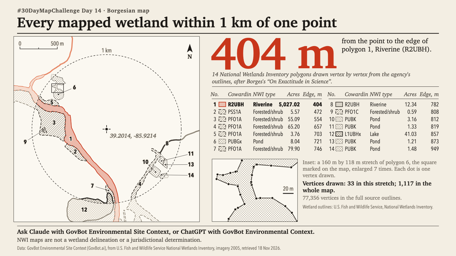
Which wetlands does the National Wetlands Inventory map within 1 km of 39.2014, -85.9214 in Columbus, Indiana, with each one's Cowardin code, type, acreage and distance to its nearest edge?
In Claude, add "GovBot Environmental Site Context"; in ChatGPT, add "GovBot Environmental Context" once, then turn it on in the chat. Every listing is at govbot.ai.
Data: GovBot Environmental Site Context (GovBot.ai), from U.S. Fish and Wildlife Service National Wetlands Inventory, imagery 2005, retrieved 18 Nov 2026.
How it was made: Data from the GovBot listing named above; map made with Claude, an AI model, and reviewed before publication.