#30DayMapChallenge · Day 13 · Interactions · Friday 13 November 2026
Landslide records near large earthquakes
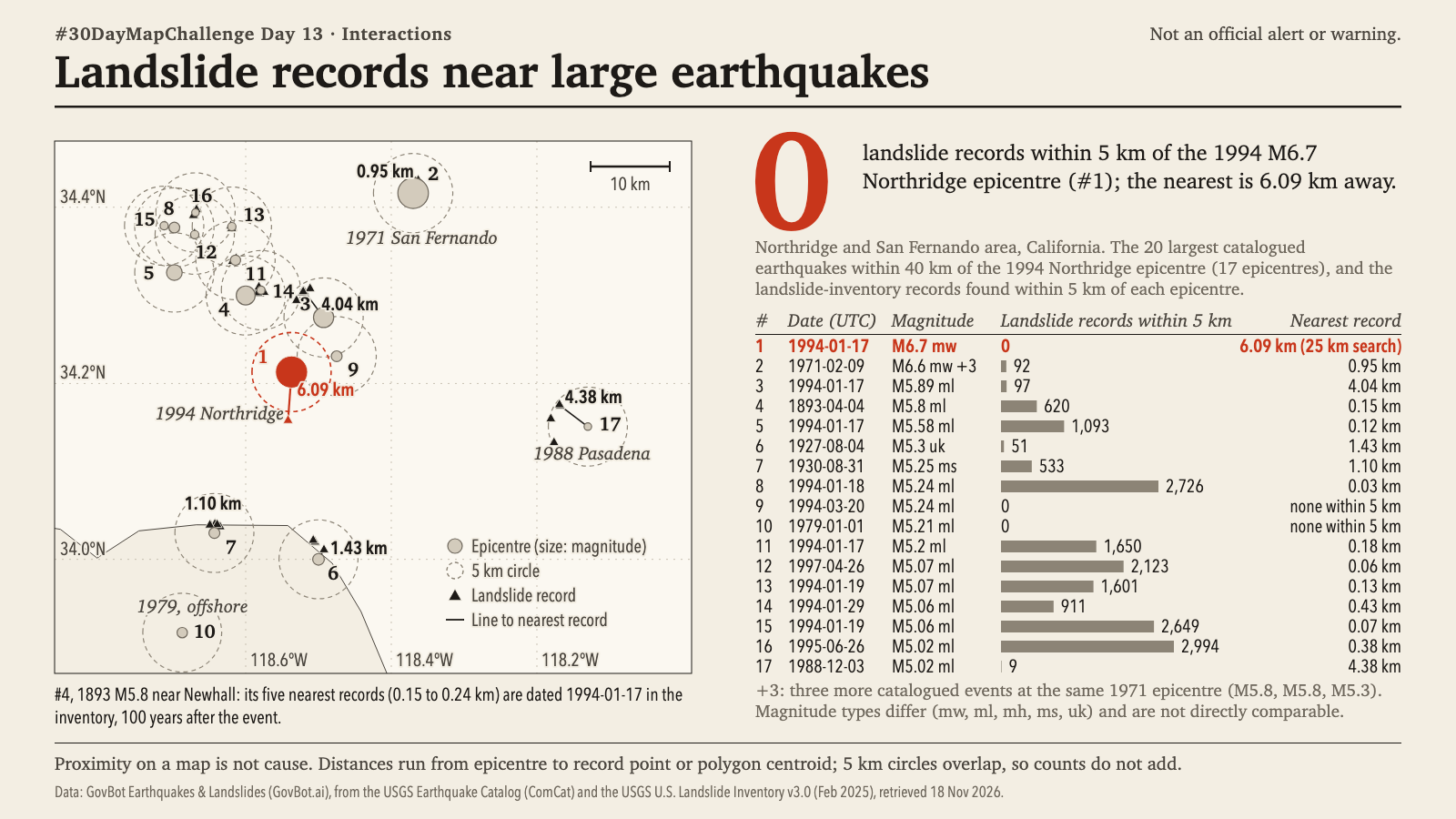
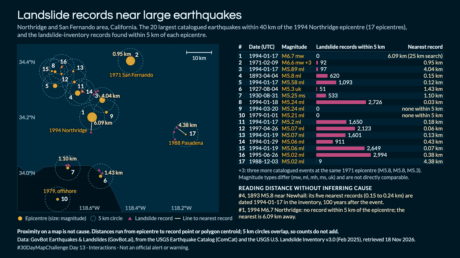
Animation: epicentre by epicentre in table order, each epicentre and its 5 km circle appear, then its nearest landslide records, nearest first, then its count and nearest distance. The order is a reading order, not a sequence in time; nothing moves. 18 seconds, with sound; the player starts muted. Still image · Animation file (MP4)
Animation: epicentre by epicentre in table order, each epicentre and its 5 km circle appear, then its nearest landslide records, nearest first, then its count and nearest distance. The order is a reading order, not a sequence in time; nothing moves. 18 seconds, with sound; the player starts muted. Still image · Animation file (MP4)
Which inventoried landslides lie within 5 km of this earthquake epicentre, and how far away is the nearest one?
In Claude, add "GovBot Earthquakes & Landslides"; in ChatGPT, add "GovBot Earthquakes & Landslides" once, then turn it on in the chat. Every listing is at govbot.ai.
Data: GovBot Earthquakes & Landslides (GovBot.ai), from the USGS Earthquake Catalog (ComCat) and the USGS U.S. Landslide Inventory v3.0 (Feb 2025), retrieved 18 Nov 2026.
How it was made: Data from the GovBot listing named above; map made with Claude, an AI model, and reviewed before publication. The animation shows the same records as the still image, and begins and ends on it.