#30DayMapChallenge · Day 16 · Collaborative map · Monday 16 November 2026
Hurricane Helene in North Carolina: FEMA declarations and NWS flood records
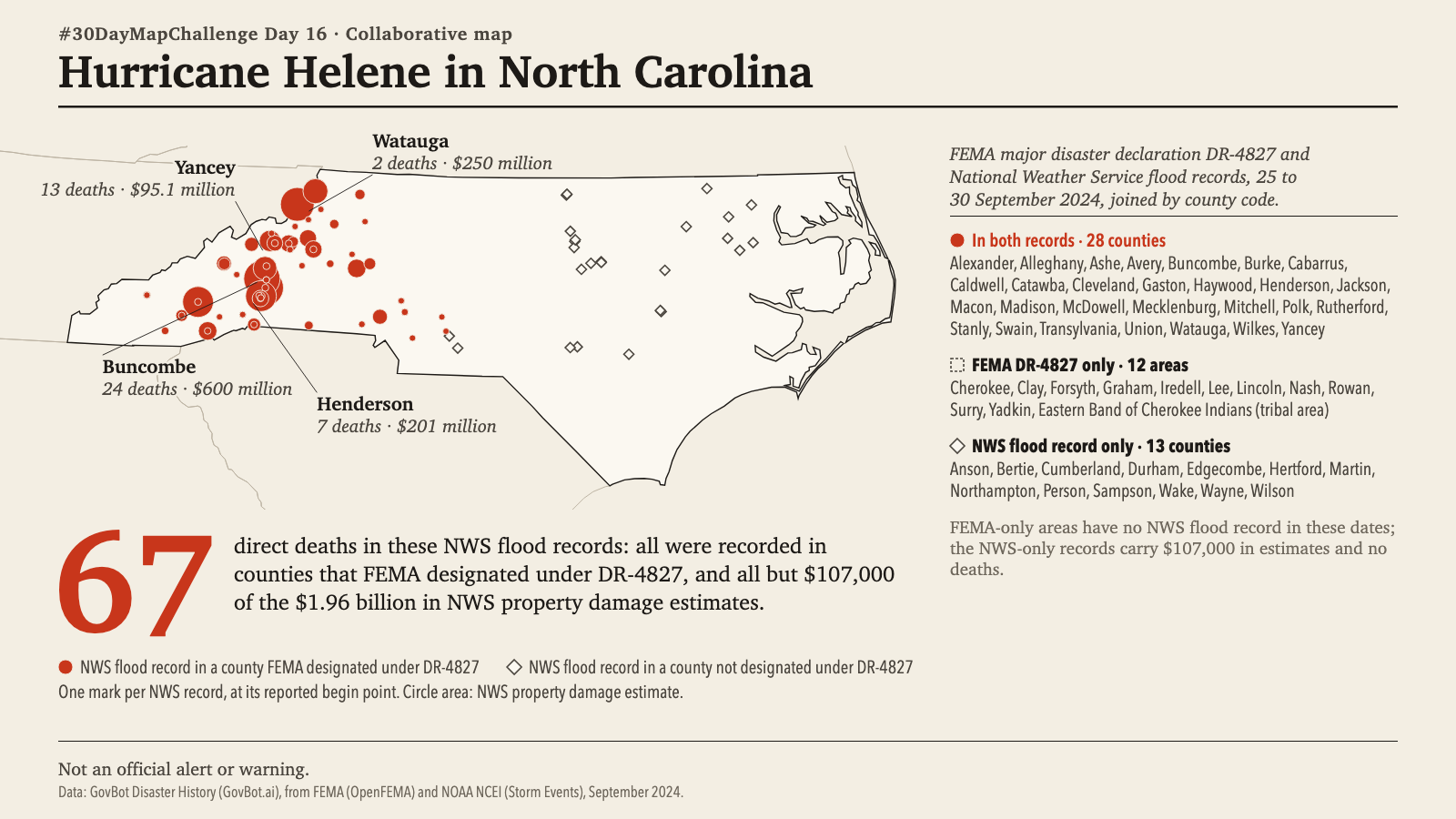
Animation: NWS flood records appear at their begin times, one second per day. Each record is then marked by whether FEMA designated its county, county by county in list order; that step is not a sequence in time. 20 seconds, with sound; the player starts muted. Still image · Animation file (MP4)
Animation: NWS flood records appear at their begin times, one second per day. Each record is then marked by whether FEMA designated its county, county by county in list order; that step is not a sequence in time. 20 seconds, with sound; the player starts muted. Still image · Animation file (MP4)
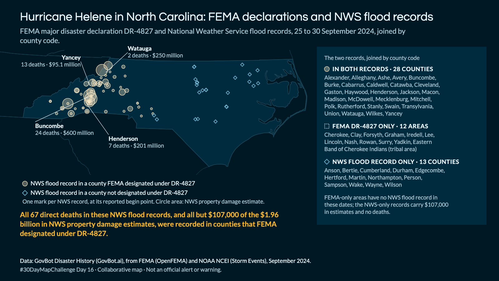
Which North Carolina counties did FEMA designate under the Hurricane Helene declaration in 2024, and what deaths and damages did the National Weather Service record for flooding in those counties from 25 to 30 September 2024?
In Claude, add "GovBot Disaster History"; in ChatGPT, add "GovBot Disaster History" once, then turn it on in the chat. Every listing is at govbot.ai.
Data: GovBot Disaster History (GovBot.ai), from FEMA (OpenFEMA) and NOAA NCEI (Storm Events), September 2024.
How it was made: Data from the GovBot listing named above; map made with Claude, an AI model, and reviewed before publication. The animation shows the same records as the still image, and begins and ends on it.